
In brief
The United Nations General Assembly has approved a resolution to replace the centuries‑old Mercator map with a more accurate representation of Africa, a step backed by 164 countries. The new map, called the Equal Earth projection, restores Africa’s real area and addresses long‑standing criticism that the Mercator design understates the continent’s size. While the vote is non‑binding, it will influence the maps institutions use worldwide. Critics warned that the distorted map has long misrepresented African resources, culture and influence.
The UN General Assembly has voted to replace the traditional world map with one that better reflects Africa’s true size.
The resolution, named Correct the Map and backed by the African Union, secured the support of 164 countries, including France and the United Kingdom. The United States was the only country to vote against it, and six nations abstained.
Although the vote is non‑binding, it will prompt many institutions to change the maps they use in schools, governments and media.
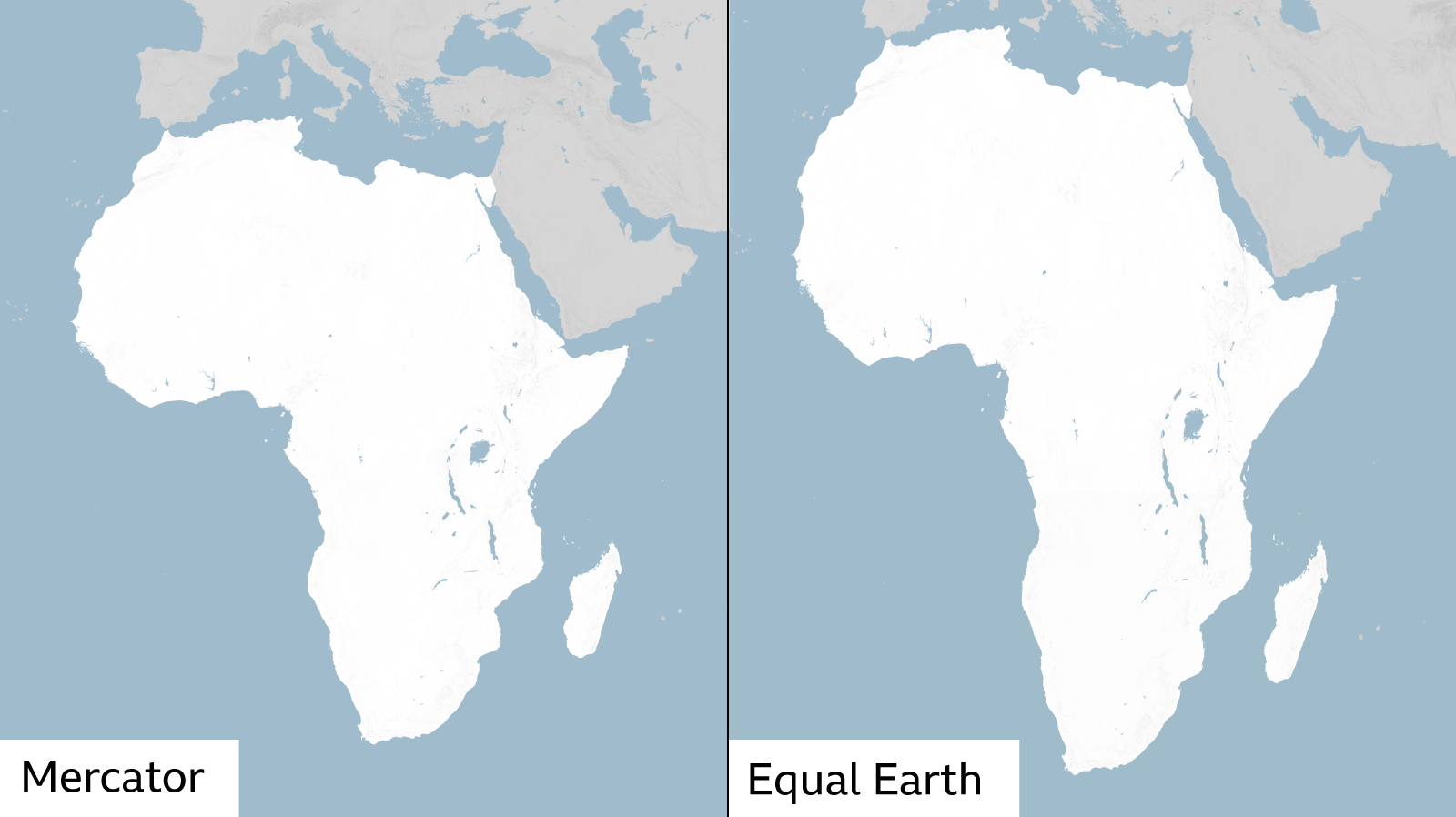
The long‑used Mercator map, created in 1569 for European explorers, shows Africa almost the same size as Greenland – even though Africa is about fourteen times larger. This distortion has made the continent’s wealth, population and future opportunities appear far smaller than they really are.
“Maps are more than guides for travelers; they shape political and economic perception,” said Kenyan geographer Kioko Muendo. The new Equal Earth map, created in 2018 by cartographers, gives Africa a proportionally accurate shape and size.
In February, the AU’s 54 member states adopted the new projection, arguing it better represents all continents. The move is part of a larger campaign called Correct The Map that has called out the Mercator map as a source of misinformation worldwide.
Togo’s foreign minister, Robert Dussey, told a UN briefing that a fair world begins with a fair map. He was joined at the UN by French officials who said they would stop using Mercator maps in official documents.
“Changing the map doesn’t change the world, but correcting a distorted representation is an act of truth,” added Dussey.
The resolution also sparked criticism from U.S. representative Yaryna Ferencevych, who said it mocked the UN’s purpose. She pointed out that the United Nations should address real global issues instead of debating map history.